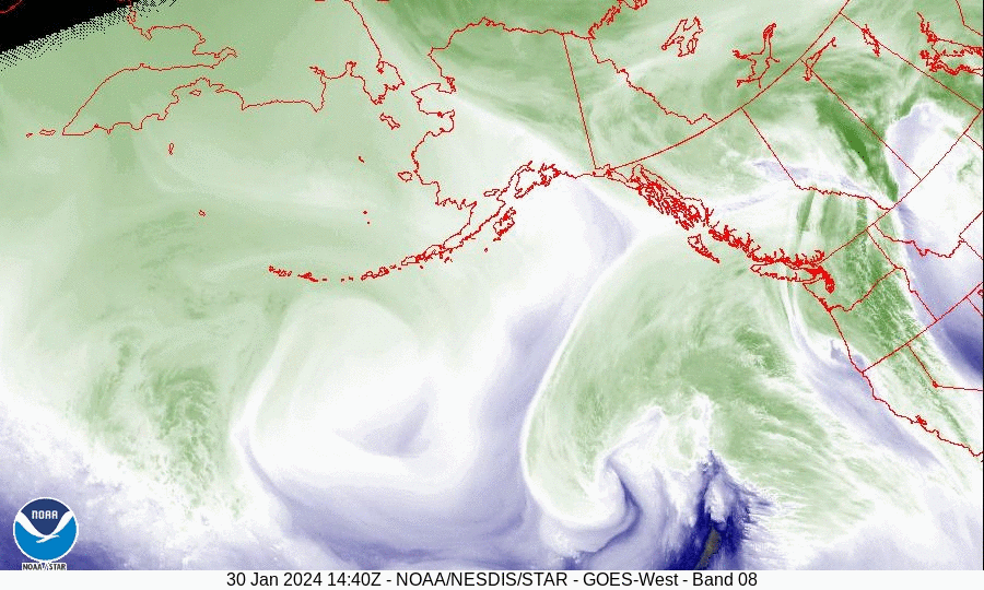
Lots of things coming, one tomorrow, but a quick shot of some striking weather imagery: the water vapor loop of an incoming storm off the Pacific. It will hit the west coast tomorrow, abate a little, and then be followed by a second round. Some very wet days ahead.
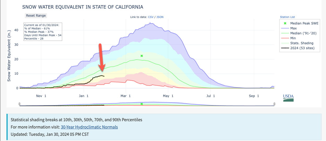
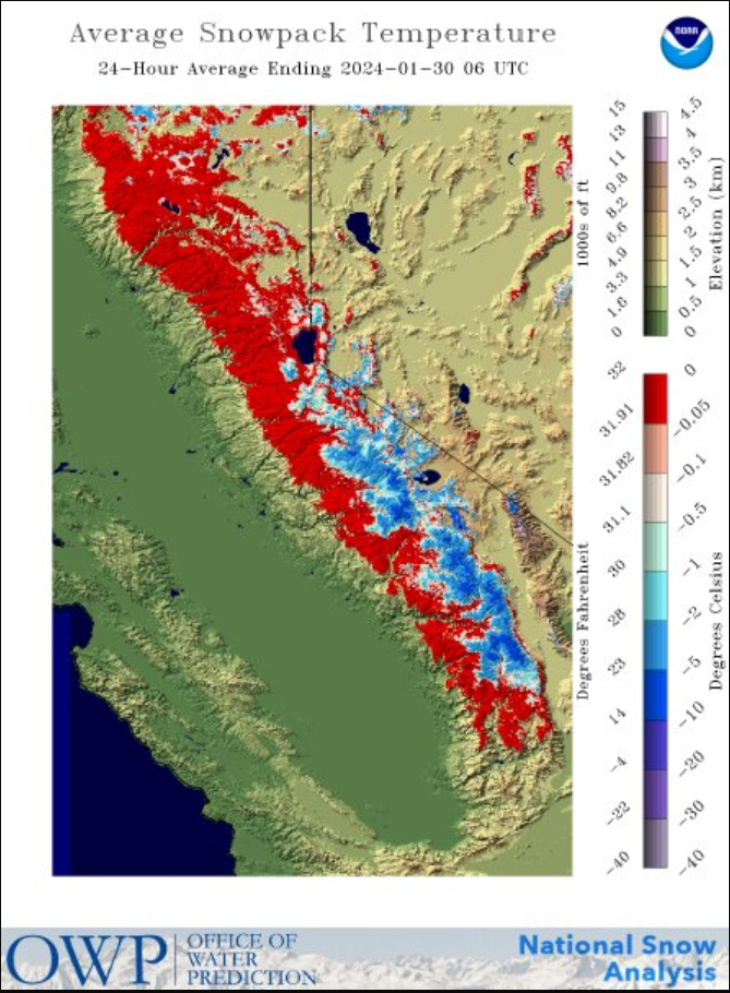
Hugely necessary moisture, even if nothing like last year, with the Sierra Nevada snowpack having been smoked. quite literally, by a week of near-record heat. Check the mean snowpack temperature, as below. You don't typically see such a uniformly wet snowpack at all elevations before spring. But it's January.
Of course, this has come with vast melting. By my estimation, we have lost more than 500, 000 acres of snow cover, mostly on the western side of the Sierras, in the last ten days. Staggering. More importantly, it sharply depleted the snow-water equivalent water reservoir that is the Sierras.